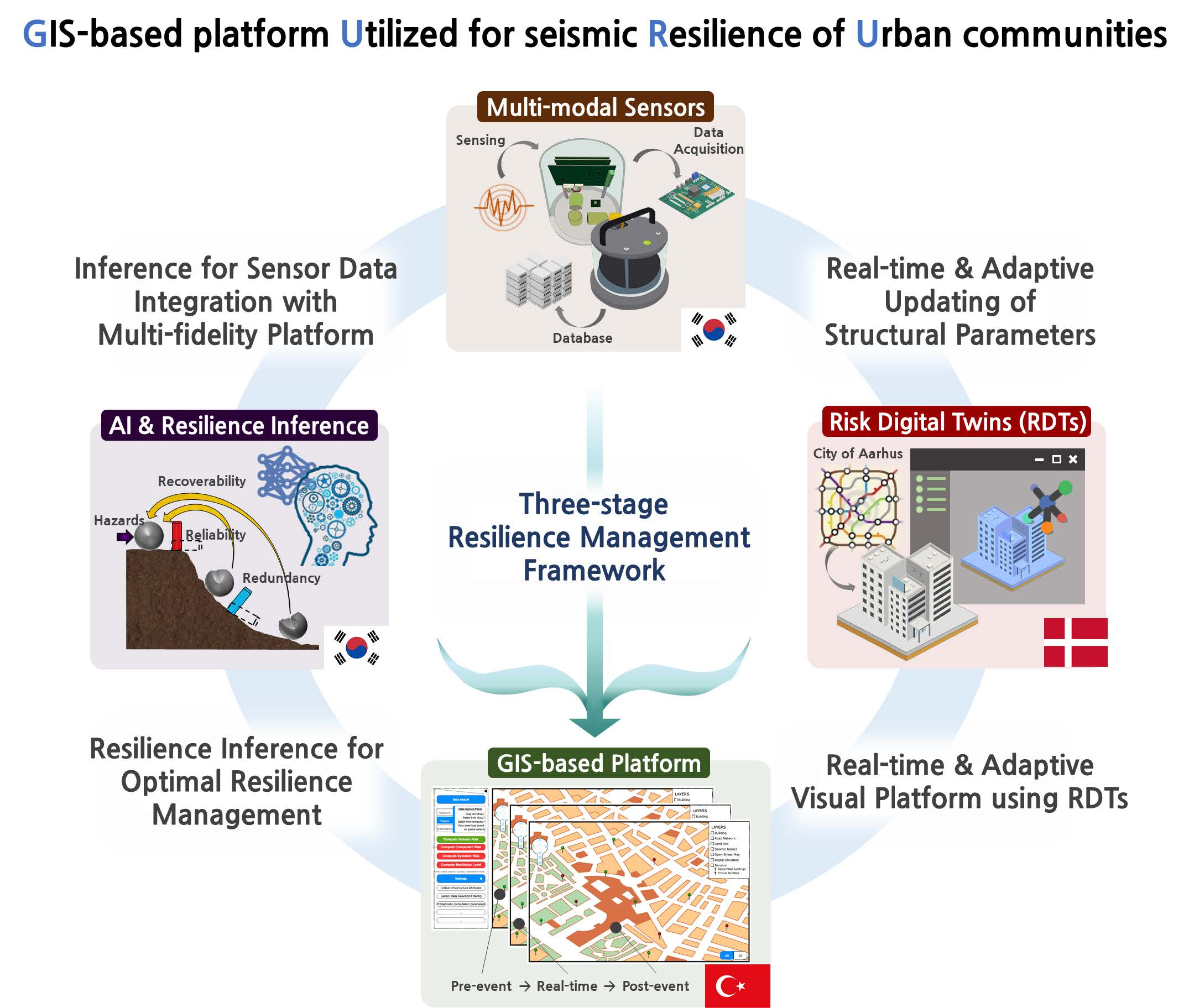
GIS-based platformUtilised for seismicResilience ofUrban communities
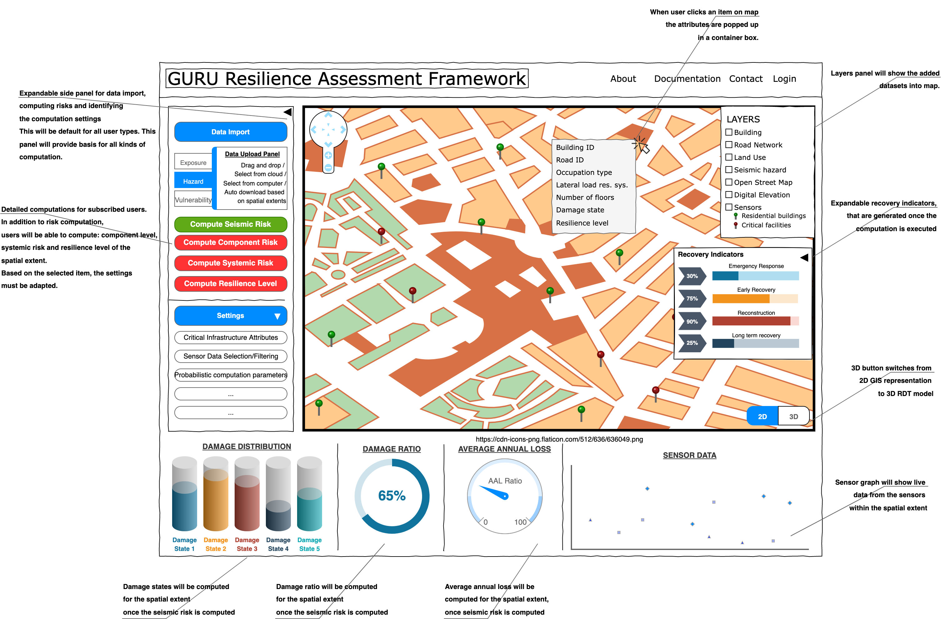
GURU connects hazard data, building inventories, sensor streams, AI inference, and recovery analytics in one decision-ready environment for cities.
The consortium design converges on pre-event preparedness, event-time sensing, and post-event recovery intelligence.
One platform across pre-event, real-time, and post-event operations
GURU brings together resilience science, GIS engineering, sensing, structural inference, digital twins, and recovery planning within a unified product vision.
A shared architecture for risk, sensing, AI, and recovery
GURU is not just a map viewer, but a full workflow linking seismic hazard, community resilience, structural response, and decision support.
What the current concept already makes clear
GURU is designed as a modular environment where spatial data, structural logic, and recovery intelligence are integrated instead of handled in isolation.
International partners shaping one shared platform
The project structure links academic research, applied engineering, sensing technology, GIS product development, and urban testbed thinking across South Korea, Denmark, and Türkiye.
International coordination continues to sharpen the platform direction
Partner briefings show steady progress across work packages, with pilot-area sensor installation planned for the coming months to support field-ready validation.